

Although it does not have a river running through it, as other Italian cities do, Bologna is to all intents and purposes a city on water: Via Piella is in fact only one of the points from which its canals can be seen.
Let's discover Bologna's network of waterways, created in the Middle Ages and then almost entirely covered in the second half of the 20th century.
The 5 canals of Bologna
There are five canals flowing underground in Bologna: the Navile, the Savena, the Cavaticcio, the Canale delle Moline and the Reno. The construction of these artificial waterways dates back to the 12th-16th centuries, when the rivers near Bologna were diverted to provide the city with the water needed for mills and factories, as well as for the trade that ensued.
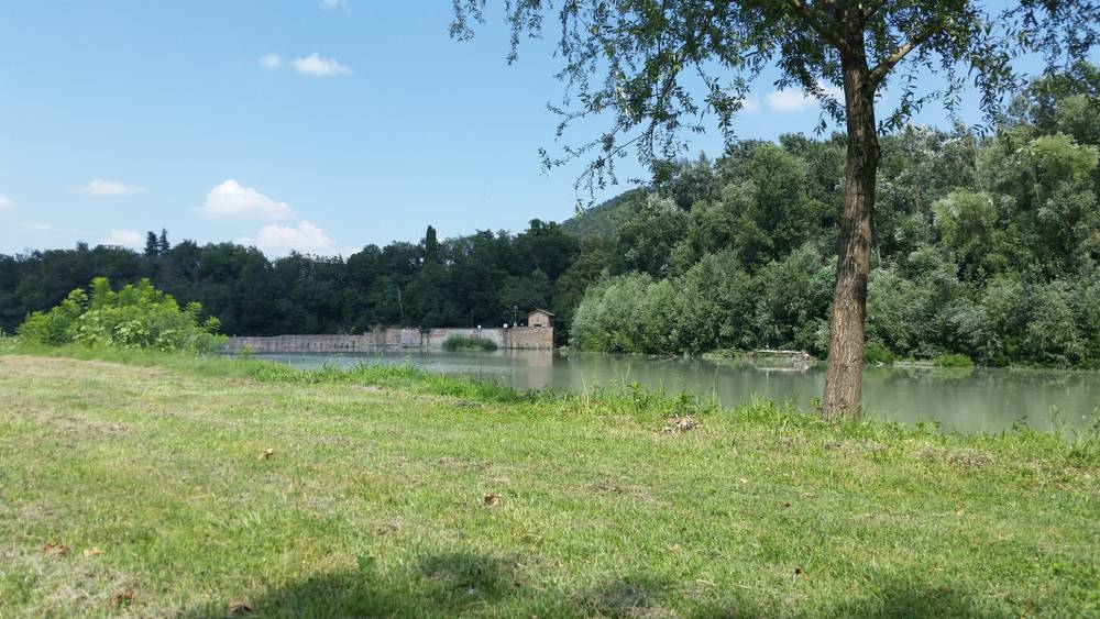
The Reno canal, in particular, still flows through the city today thanks to the diversion of the river of the same name in the 12th century at the Chiusa di Casalecchio, an imposing hydraulic work located a few kilometres outside Bologna.
The Reno Canal in Via della Grada
The course of the Reno Canal was closed in the last century and is therefore no longer fully visible except for the section that emerges at the Opificio della Grada, located in the street of the same name. The factory was founded in 1681 as a tannery, but even earlier it served as a control point for goods and people entering the city via water.
Leaving the centre at Porta Sant'Isaia, in the direction of Casalecchio, it is possible to follow the course of the Reno Canal, which rises to the surface in various stretches. You can observe it for example near the Certosa Cemetery, and then continue following it towards the Chiusa and its park.
Cavaticcio Park
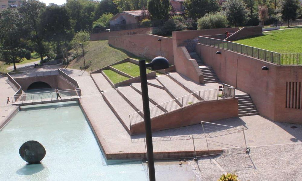
In the city centre there is also a branch of the Reno called Cavaticcio, which used to flow near today's Parco del Cavaticcio. The park is one of the most significant places in the city, as this was the site of Bologna's ancient urban port, the nerve centre of all trade in the city. Today, the area has been transformed into a cultural and artistic hub, hosting various events and festivals in summer.
To observe it from above, you can look out from the little wall on Via Don Minzoni, which also offers a beautiful view of the old salt warehouse - the Salara - now home to the Cassero, Bologna's LGBTQ+ centre.
Via delle Moline
One of the main purposes of creating a network of canals in Bologna was to bring water to the city mills. Today they have all disappeared, but some street and square names still evoke their presence in the city.
One example is Via delle Moline, located a stone's throw from the station and the shopping street, Via Indipendenza. Here it is possible to observe a rather long stretch of the Reno Canal, which was brought to light in 1998 showing its course perpendicular to streets such as Via Malcontenti, Via Piella (that of the famous Finestrella) and Via Oberdan.
.jpg)
Via Capo di Lucca
Our tour of Bologna's canals ends a few metres away from Via delle Moline, in Via Capo di Lucca. From this street you cannot actually see the canal, but the sound of the water can be heard loud and clear. At this point, the canal creates a sort of waterfall and thus flows faster than in other places.
In the past, cloth and grain were processed in Via Capo di Lucca, as evidenced by the series of buildings on the right, entering the street from Via Righi, built in the 16th century to house the millers.